News

Uplift continues beneath Svartsengi but the rate has decreased
Update 22. April kl. 12:30 UTC
Uplift in Svartsengi continues, but the rate has significantly decreased and is now similar to the period before the eruption that began on April 1. As magma accumulation continues beneath Svartsengi, repeated magma intrusions and even eruptions in the Sundhnúkur crater row must be considered.
Read more
Uplift continues beneath Svartsengi
Updated April 8, at 16:15 UTC
Deformation measurements clearly show that uplift beneath Svartsengi is ongoing. The current uplift rate is faster than that observed following previous eruptions. This may be explained by the large volume of magma — around 30 million cubic meters — that was released from the system during the most recent event.
However, it is still too early to predict how the rate of magma accumulation will develop. Past events have shown that accumulation rates typically decline as more time passes between eruptions. At least a week, and possibly several weeks, will need to pass before we can evaluate if — and how — the rate of accumulation will change.
Read more
Eruption at the Sundhnúkur crater row remains likely
Updated 25. March at 15:00 UTC
GPS deformation data shows that magma continues to accumulate beneath Svartsengi, although the pace of land uplift has slightly decreased in recent weeks. Despite the slower uplift, experts still consider it likely that a magma intrusion and/or eruption will occur along the Sundhnúkur crater row.
Read more
Earthquake swarm ongoing offshore Reykjanestá
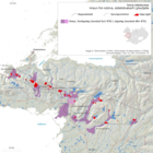
At around 14:30 yesterday (12 March 2025), a rather intense earthquake swarm began offshore Reykjanestá. The swarm was most intense at the beginning when about 50 – 60 earthquakes were recorded in the first few hours. As the day progressed, the activity decreased but then increased again shortly before midnight when an earthquake of magnitude 3.5 occurred. When the activity increased again in the evening, it shifted slightly westward as the image shows (blue circles indicate the location of earthquakes that occurred at the beginning of the swarm yesterday, while yellow and red ones show earthquakes from late last evening and night).
Read more
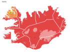
Red weather warnings in effect today – no travel recommended
A southerly storm or violent storm is expected later today and tomorrow, with very strong wind gusts, widely 35 – 45 m/s and especially near mountains, but locally exceeding 50 m/s. Considerable or heavy rain is expected in the south and the west regions of the country. More details can be found here.
Read moreThe weather in Iceland in 2024
The year 2024 was remarkably cold compared to temperatures of this century. The national average temperature was 0.8 degrees below the 1991 to 2020 mean, and it was the coldest year since 1998. Lowest relative temperature was inland in the North, while it was warmer along the southern coast. The summer was wet across the entire country, but other months of the year were relatively dry. Overall, the year was drier than average in the eastern, southern, and southwestern parts of the country, but wetter than average in the North and West, which experienced heavy rain during summer. The sea level pressure was unusually low from June through August, and the summer was characterized by frequent low-pressure system passage and unfavourable weather. During other seasons, the weather was relatively calm, and annual mean seal level pressure and wind speed were around average.
Read more
New weather forecast website launched
The first phase of the Icelandic Meteorological Office's (IMO) new website was launched today. This marks the beginning of a major project aimed at renewing both the website and its entire technical infrastructure.
The new weather forecast website is available at https://gottvedur.is/en/. While the site is still in development, once the renewal of the current website is complete, the new weather pages will be moved to the domain vedur.is.
Read more
Earthquakes continue to be recorded at great depths near Grjótárvatn
Updated 17. January 14:00 UTC
Seismic activity continues to increase near Grjótárvatn. So far in January, nearly 100 earthquakes above M1.0 have been recorded. This is comparable to the total number of earthquakes in December 2024, which was the highest monthly count ever recorded in the area.
Read more
Strong earthquake swarm in Bárðarbunga. Largest earthquake magnitude 5.1
A strong earthquake swarm began shortly after 6:00 UTC today in the
northwestern part of the Bárðarbunga caldera. Approximately 130 earthquakes
have been recorded since the swarm began, with the largest reaching magnitude
5.1 at 8:05 UTC.
Additionally, 17 other earthquakes with a magnitude of 3 or higher were detected, including at least two measuring magnitude 4 or above. These estimates may change as analysis of the events is ongoing.
Read more
Glacial outburst flood from Grímsvötn likely in progress
In recent days, a gradual increase in seismic tremor has been recorded on the Grímsfjall seismometer, suggesting that a glacial outburst flood has begun from Grímsvötn. These floods emerge from the base of Skeiðarárjökull glacier, flowing into the Gígjukvísl river. Typically, these glacial outburst floods increase gradually, and it can take a few days for the first signs of floodwater to be detected at the hydrological station in Gígjukvísl river and an additional few days before peak discharge is reached. With precipitation in southeast Iceland in the past days, and more expected in the coming days, the identification of the initial signs of the flood In Gígjukvísl could prove to be challenging.
Read more


