News

Ground uplift under Svartsengi area continues at a stable rate
A photogrammetric survey was conducted by Icelandic Institute of Natural History and Landmælingar Íslands in a flight over the eruption site 13 December. The data reveals that the lava field that was formed during the last eruption (20 November to 9 December) had a total volume of 49,3 million cubic meters erupted and covered an area of 9,0 square kilometers. The thickest part of the lava field was around the craters and close to the barriers by the Blue Lagoon but the average thickness of the lava was 5,5 meters.
Read more
Ground Uplift and Magma Accumulation Continue Beneath Svartsengi
Updated 19. November at 14:45 UTC
Seismic activity in the Sundhnúkar crater row remains relatively low. A few earthquakes have been recorded daily, most of them located between Stóra-Skógfell and Sýlingarfell. On some days in the past week, bad weather has affected the sensitivity of the seismic monitoring system, potentially obstructing the detection of the smallest earthquakes.
Read more
Continued greenhouse gas emissions could trigger a regional cooling around the North Atlantic
Continued greenhouse gas emissions increase global warming, but could trigger a regional cooling around the North Atlantic. In an open letter released today at the Arctic Circle conference in Reykjavík, Iceland, 44 leading experts on ocean circulation and tipping points from 15 countries appeal to the Nordic Council of Ministers to take this risk seriously, initiate a risk assessment and take steps to minimize this risk as much as possible.
Read more
New Icelandic Met Office weather and climate supercomputer, becomes operational
The National Meteorological Institutes of Iceland, Denmark, Ireland and the Netherlands have joined forces to respond to climate change with more timely weather forecasting on a new, now operational, common supercomputer. This helps prepare each nation for the impacts of weather patterns, which are expected to become more extreme and more challenging to forecast.
Read more
Important to continue developing volcanic hazard assessment methodology
The Icelandic Meteorological Office is legally responsible for real-time natural hazard monitoring and to provide warnings and forecasts of impending hazards from e.g. earthquakes, volcanoes and glacial outburst floods. The Met Office also has the role of advising authorities about the prevention of and response to natural hazards. Part of this responsibility is to regularly assess and provide information about volcanic hazards such as he recent unrest on the Reykjanes Peninsula.
Read more
One month since the start of the eruption at the Sundhnúkur crater row
Today marks one month since the beginning of the eruption that is ongoing at the Sundhnúkur crater row. The eruption, which began on the evening of March 16, is the fourth in a series of eruptions that started when magma began accumulating beneath Svartsengi in late October 2023.
Read more
Seismic swarm in the northwest past of the caldera in Askja yesterday
Yesterday (25 March) a seismic swarm occurred in the NW part of the Askja caldera. About 30 earthquakes were detected between 08.00UTC and midday. The largest earthquake detected had a magnitude M3,5 at a depth of about 5 km. Three earthquakes with magnitudes between M2 and M2,5 were also detected, the rest of the activity was characterized by smaller events. Overall, the seismic activity in the Askja has been quite stable between months and unchanged until yesterday. Looking back, we can see that earthquakes with magnitude above M3 were detected in January 2022 and October 2021.
Read moreThe weather in Iceland in 2023
The weather in 2023 was mostly favorable. It was calm, dry, relatively little snow and stormy days were quite uncommon. However, the year was cooler compared to the most recent years. The average nationwide temperature was 0.1°C colder than the average temperature between 1991 and 2020, and 0.4°C colder than the average temperature of the last ten years. It was relatively coldest in the North, while the Southwest and Southern coast were relatively warmer. The weather was particularly cold in the beginning of the year and again in March. June, on the other hand was exceptionally warm in the North and East. It was the warmest June on record in many places in those regions. The year was relatively dry, with precipitation below average across most of the country. There were several dry periods during the year, such as in March and July, but there were also periods of heavy rain in between. May and June were particularly wet and gloomy in the southern and western regions.
Read more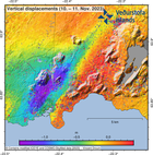
New understanding of ultra-rapid formation of magma filled cracks in the Earth
On 10 November 2023 the town of Grindavík in Iceland was evacuated as massive amounts of magma suddenly flowed into a magma filled crack that propagated underneath the town. Magma was emplaced in a 'vertical sheet' type intrusion in the Earth's crust. An international team of scientists explains the formation of the intrusion, and conditions for ultra-rapid flow into cracks, in a new publication in the prestigious scientific journal Science.
Read more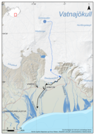
Conclusion of Grímsvötn Glacial Outburst Flood
Updated 23 January at 9:00 UTC
Since the glacial flood reached its peak in the river Gígjukvísl approximately a week ago, the water level has been decreasing and is now comparable to what it was before the flood. The seismic tremor measured on the seismometer at Grímsfjall has also declined, with seismic noise now back to normal levels. Since last week Monday, 21 earthquakes have been recorded in Grímsvötn, including two earthquakes exceeding magnitude two.
Read more


