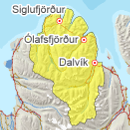
Avalanche bulletin - Tröllaskagi 
-
Tue Apr 30

Moderate danger -
Wed May 01
Moderate danger -
Thu May 02
Moderate danger
Snow has subsided widely in thaw from a week ago, but less thaw occurred in high elevations where snow is layered and weaknesses persist. Snow is affected by diurnal temperature fluctuations and solar radiation, especially in S facing aspects.
Avalanche problems in the area
-
Type
-
HeightAbove 800 m.
-
Aspect
-
Probability
-
Size
Weakness is possibly still present high in the mountains where thawing has had less effect.
-
Type
-
HeightBelow 600 m.
-
Aspect
-
Probability
-
Size
Sun exposure could trigger small wet avalanches.
Snow layers and snow cover
Thaw and warming started last week and snow has subsided and stiffened somewhat, but considerable snow remains high in the mountains and weak layer can persist at high elevations. A snowpit from Burstabrekkudalur last week gave CT11RP but ECTX on a weak layer by an ice layer on top of old firn. Warm temperatures continue during the day and solar radiation affects the top layers of the snow with chance of wet avalanches, especially in S facing aspects.
Recent avalanches
Surface movement is widely seen in the region due to sun exposure and a large slab avalanche fell in Flókadalur during the weekend. A large wet loose avalanche fell in Hestskarð last week.
Weather forecast
Calm weather next days. Diurnal fluctuations and warming is expected for the next days.