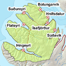
Avalanche bulletin - Northern Westfjords 
-
Tue Apr 30

Low danger -
Wed May 01
Low danger -
Thu May 02
Low danger
Skier triggered loose snow avalanche last week in Seljalandsdalur. Wet avalanches could occur af afternoon warming
The avalanche bulletin is at a regional scale. It does not necessarily represent avalanche danger in urban areas.
Snow layers and snow cover
The snowpack is likely becoming rather homogenous after freeze-thaw cycles. A snowpit from Steiniðjugil on April 23 showed a rather homogenous and isothermal snowpack. Wet sluffs could occur in afternoon warming in slopes facing the sun.
Recent avalanches
Skier triggered loose snow avalanche last week in Seljalandsdalur.
Weather forecast
Light northeasterly winds and mostly fair. Temperature above freezing during the day but frost during the night.