Instructions for cloud cover forecasts
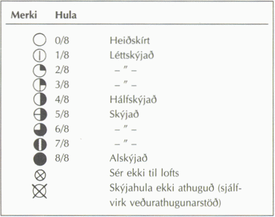
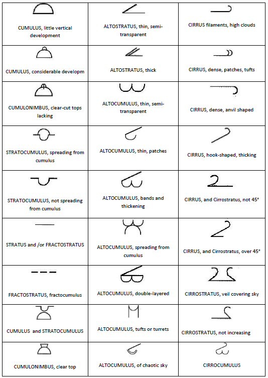
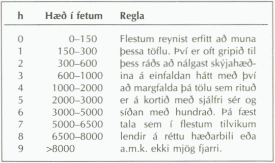
- The first map shows cloud cover measurements at a few stations in Iceland, along with information about cloud type and lowest cloud altitude (see following diagram). This information can be useful in evaluating the quality of the forecast.
- Cloud cover observations are made every three hours at a few stations in Iceland. The latest observation is shown on the map.
- When future maps are viewed only the cloud cover forecast is displayed and not any observations.
- Cloud cover forecasts appear as variegated patches over the country. The maps display cloud forecasts in eight units of cloudiness.
- 0/8 signifies a clear sky, 4/8 partly cloudy and 8/8 cloudy.
- A forecast for total cloud cover is displayed, along with a forecast for low cloud and middle cloud cover.
- In Iceland and other countries located at around the same latitude and further north, low clouds are defined as clouds located up to 2 km in altitude and middle clouds from 2 km up to 4 km in altitude. A third cloud type, not shown on a specific map (however, the information appears on the map for total cloud cover), is high clouds which can reach from 3 km up to 8 km in altitude.
Main symbols
 High clouds can reach from 3 km up to 8 km in altitude
 Middle clouds reach from 2 km up to 4 km in altitude
 Low clouds are located below 2 km in altitude
 Cloud cover is displayed in units of eight
The cloud cover displayed in units of eight

What kinds of low clouds, middle clouds and high clouds are visible?
In first column low clouds, in the next column middle clouds and the third column high clouds:
...............CL...............................CM...............................CH................

Lowest measured cloud altitude, symbolised with numbers 0 to 9


