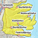
Avalanche bulletin - Eastfjords 
-
Sat Apr 26

Moderate danger -
Sun Apr 27
Moderate danger -
Mon Apr 28
Moderate danger
Old wind slabs are at high elevations and could be unstable. Chances of wet sluffs during warm weather, rain and sun in then next few days.
The avalanche bulletin is at a regional scale. It does not necessarily represent avalanche danger in urban areas.
Avalanche problems in the area
-
Type
-
HeightAbove 400 m.
-
Aspect
-
Probability
-
Size
We sluffs could release with rising temperatures.
-
Type
-
HeightAbove 400 m.
-
Aspect
-
Probability
-
Size
Old wind slabs likely present.
Snow layers and snow cover
Old wind slabs are at high elevations, and will likely become stronger with warming weather. More snow is in the northern part of the area. Chances of wet sluffs in the warm weather, rain and sun in the next few days.
Recent avalanches
Wet sluffs released in the area last week. Wet avalanche released in Bræðslugjár on April 25.
Weather forecast
Rain the night before Saturday, partly cloudy but becoming fair on Sunday.