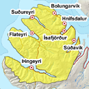
Avalanche bulletin - Northern Westfjords 
-
Thu Apr 25

Moderate danger -
Fri Apr 26
Moderate danger -
Sat Apr 27

Low danger
Saturday was warm with rain and a few avalanches occurred. Wet avalanches could occur while the snowpack adjusts.
Avalanche problems in the area
-
Type
-
HeightAll heights
-
Aspect
-
Probability
-
Size
Wet avalanches possible.
Snow layers and snow cover
The snowpack is most likely becoming rather homogenous after frost and thaw cycles. A snowpit made in Steiniðjugil on April 23 showed a rather homogenous and isothermal snow. Some wet sluffs could occur in the next few days and some layering could still be in the snowpack at high elevations. Two large slush avalanches have occurred after it stopped raining, in steep waterways. Danger of slush avalanches is expected to decrease as temperatures drop.
Recent avalanches
Quite a few avalanches occurred in the thaw over the weekend. A large slush avalanche occurred in Seyðisfjörður on the evening of April 21st and another one occurred in Hestfjörður on the evening of April 22nd.
Weather forecast
Light variable winds in the next few days and mostly fair. Temperature above freezing during the day but frost at night. Looks like northeasterly wind on Saturday with falling temperature.