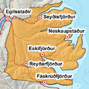
Avalanche bulletin - Eastfjords 
-
Sat Apr 20

Considerable danger -
Sun Apr 21
Considerable danger -
Mon Apr 22

Moderate danger
Thaw is forecasted over the weekend which increases chances of wet avalanches. Considerable snow is at high elevations and inland after NE-snow in recent weeks. Weak layers are expected to be present between wind slabs. New snow is widely in the area and cornices at high elevations.
Avalanche problems in the area
-
Type
-
HeightAll heights
-
Aspect
-
Probability
-
Size
Thaw during the weekend increases chances of wet avalanches.
Snow layers and snow cover
A lot of snow has accumulated at high elevations after snowfall in NE-winds in recent weeks. The snow is layered, with windslabs of different hardness where a weakness could persist. A weakness deep in the snowpack could still be found at high elevations. A layer of new snow accumulated early this week and cornices are widely on S-W aspects. A thaw is expected during the weekend with increased chances of wet avalanche activity.
Recent avalanches
Several loose avalanches seen by Neskaupstaður on Tuesday and Wednesday. Few small avalanches have been seen around the area after last weeks snowfall and warming.
Weather forecast
Some snow on Friday evening in S-winds. Sharp rise in temperature on Saturday with thaw up to the mountain tops. Chances of snowshowers. Becoming W-wind on Sunday with colder temperature at high elevations. Monday looks like dry and mild weather.